Pinnacle Rock
Pinnacle Rock
Not accessible due to Ranch Fire
Pinnacle Rock, at 4618 feet, is one of the highest points in the southern part of the Mendocino National Forest and is centrally located in the Berryessa-Snow Mountain National Monument. Be careful not to fall; the rock is very tall and has cliffs.
The location and elevation of Pinnacle Rock made it an ideal location for the Pinnacle Rock lookout. The lookout is removed now but there are steps from the bottom of the rock to the top, where you can get almost an unobstructed 360 degree view. To the north and northwest you can see Snow Mountain and Goat Mountain. The valley immediately to the east follows the trace of the seismically active Bartlett Springs Fault Zone. To the south and southeast you can see the active Clear Lake Volcanic Field that includes Clear Lake and Mount Konocti.
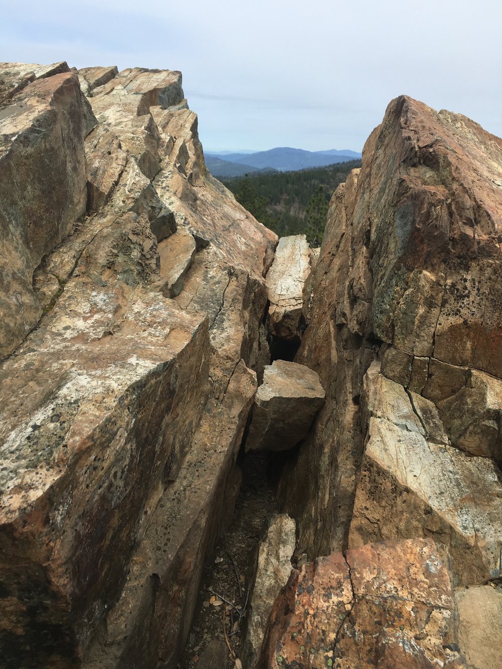
Pinnacle Rock is a very large outcrop of greenstone or metamorphosed basalt. Gravity and mass wasting processes have caused it to split open along fractures in the rock. These can create places where wildlife can seek shelter -- so please be careful and try not to disturb wildlife.
Many large rocks like this occur throughout the Mendocino National Forest, especially in a geologic area known as the Central Belt of the Franciscan Assemblage. More common softer rock such as siltstone erodes away, exposing scattered outcrops of harder, more competent blocks of greenstone, greywacke and even blue schist. One can imagine this kind of geology as being similar to a gelatin fruit cake where the fruit are the harder rocks and the jello are the softer ones.